On a cloudy January morning, Sally and I took the dogs hiking to the Doppler Weather Ball via Skyline drive to Beek’s Place.
The Details
Trailhead: West Foothill Parkway, just past Trudy in Corona
Parking: Parking is free along West Foothill Parkway
Length: 12 miles round trip to the Doppler from Foothill
Elevation Gain: 2,337 feet
Difficulty: Moderate
Total time: 4-5 hours
Dogs: Yes on a leash
Water: There is a refillable water station at the trailhead.
Parking
When you hike to the Doppler you want to park on West Foothill Parkway. You will see the cars parked on the curb and they have all headed to the same place as you are going. Parking is free. Do not park in the neighborhood, because you will either get a ticket or have your car towed. There are signs on every street stating that parking is for permitted residents only.
Starting the Hike
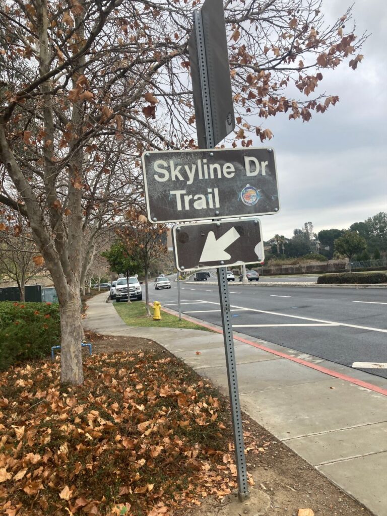
On West Foothill Parkway there is a sign for the Skyline Trail and this is where you want to start in order to hike to the Doppler. The first part of the trail is paved and it is directly behind houses. Signs along the way ask that users of the trail respect the neighbors and keep their volumes low. There is a place to refill water bottles at the beginning of the trail and there are several trash cans. After you pass the houses the trail changes to a wide dirt track. At about ¾ of a mile, you will come to a giant map showing all the different hiking trails in the area. If you want to hike to the Doppler you will need to veer right and head up the fire road.
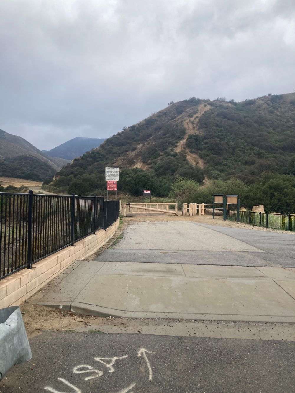
The Fire Road to the Doppler
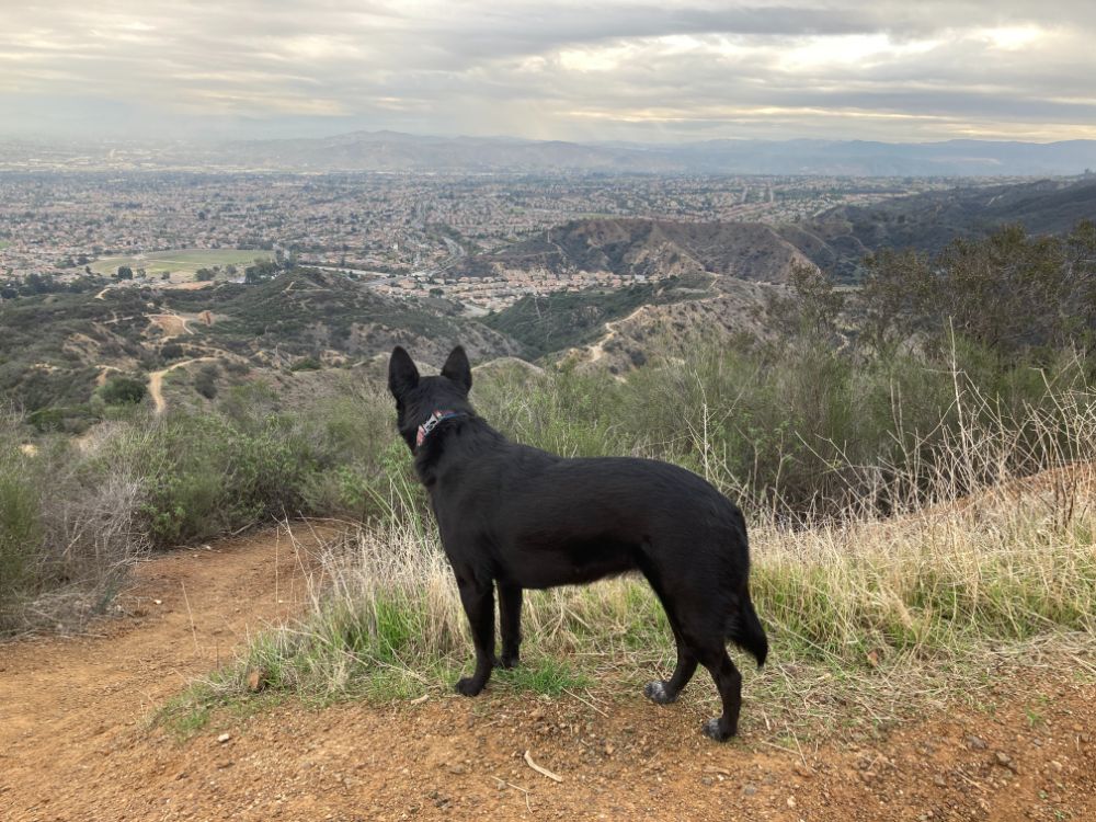
Hiking the Fire Road to the Doppler is a constant uphill. You will be sharing the trail with hikers, runners, and mountain bikers. The day we hiked we saw 3 cars on the trail, but I don’t think that is the norm, because the gate at the bottom is locked. The trail consists of one switchback after the other. If it’s a clear day it doesn’t take long to have views of the Inland Empire. We were able to see the city of Corona, Blue Mountain, Mt. Jurupa, Box Springs Mountain, and Mt. Baldy.
Beware of the Heat
You should not plan to hike to the Doppler Ball if it is hot outside. There is no shade at all. This is a hike that calls for a hat and sunscreen. If it is warm, bring a lot of water. There is nowhere to refill your water once you start up the fire road.
Hiking in the Rain
Unfortunately, the day we hiked we had the opposite problem. It was cloudy and it rained. Sally and I had both checked the weather forecast the night before and no rain was predicted. About 4 miles into the hike it started to rain and at first, it was light, but at times, it really came down. Sally had a rain jacket in her backpack, but I didn’t. The weather was only 60 degrees, but by the time we had finished the hike and made it back to the car I was completely drenched and cold to my core. During one of the heavier downpours I tried to shelter under a bush and I looked in my backpack and found my emergency space blanket in case I needed to wrap it around myself.
I always bring a backpack and I usually have all of my 10 essentials, because I never know when I will need them. Needless to say, my raincoat is going back in my backpack. Every hiker should have the following with them:
Ten Essentials For Hiking
- Appropriate footwear: I always fear for the people I see sliding down the hill in their Vans or Converse or worse yet flip-flops.
- Maps/Compass/GPS: Cell phones are a great tool, but 9 times out of 10 I don’t have service. Furthermore, living in Southern California I need to be able to find another route off the mountain in the case of a forest fire.
- Water: A good rule of thumb is to plan for ½ liter of water for every hour you’ll be hiking for moderate and strenuous hikes. For long hikes, I also bring a filter if I think there might be a water source that I can filter from.
- Food: Bring calorie-dense snacks. I always have emergency protein bars or wrapped snacks in my backpack in case something happens and I have to spend the night in the woods.
- Rain Gear: – fast drying layers: Although it rarely rains in California I can attest to how miserable it is to hike in the rain without a jacket. Moisture-wicking clothes are key to being happier. I keep a pair of gloves and a beanie in my backpack as well.
- Safety Items: A light, matches, and a whistle. You should have some sort of light in your backpack in case a hike takes longer than expected. I always have a headlight with me. Waterproof matches or something to start a fire and a whistle to call for help. After many years of debating, I bought a Garmin GPS mini. It gives both me and my family a peace of mind that I can call for help even if I don’t have a cell signal.
- First Aid Kit: Your kit should have supplies for injuries and illness. My kit also has an epi-pen because I’m allergic to bees.
- A Multi-tool or knife: Even though you might think you’ll never use it you might be surprised how often you actually do.
- Sun protection: Hat, sunscreen, and sunglasses.
- Shelter: I only have a tent with me when I’m backpacking, but I always have an emergency space blanket in case I need to shelter in place.
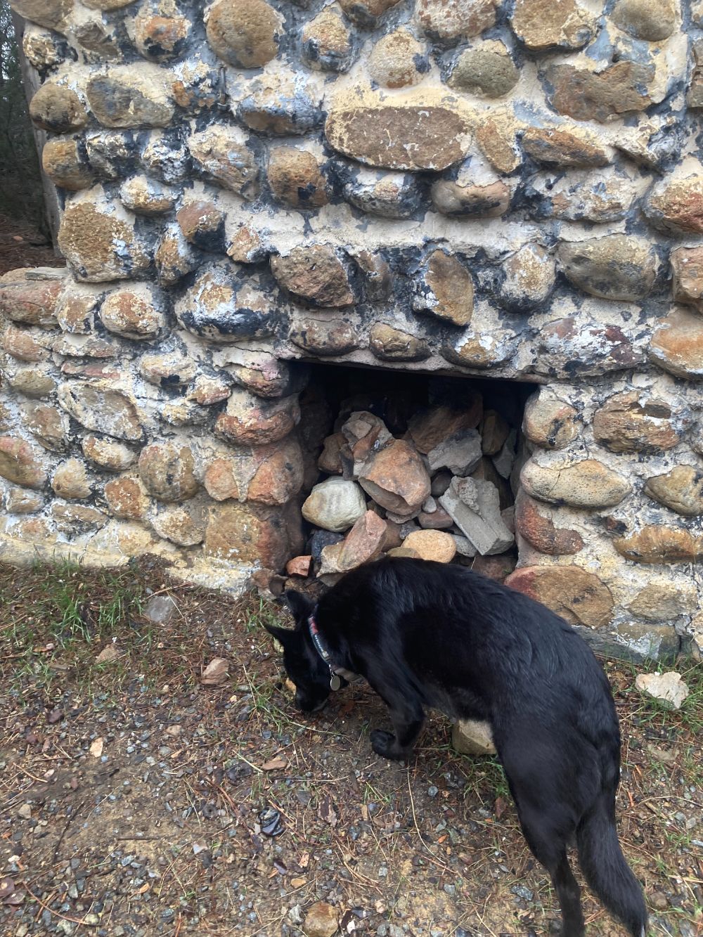
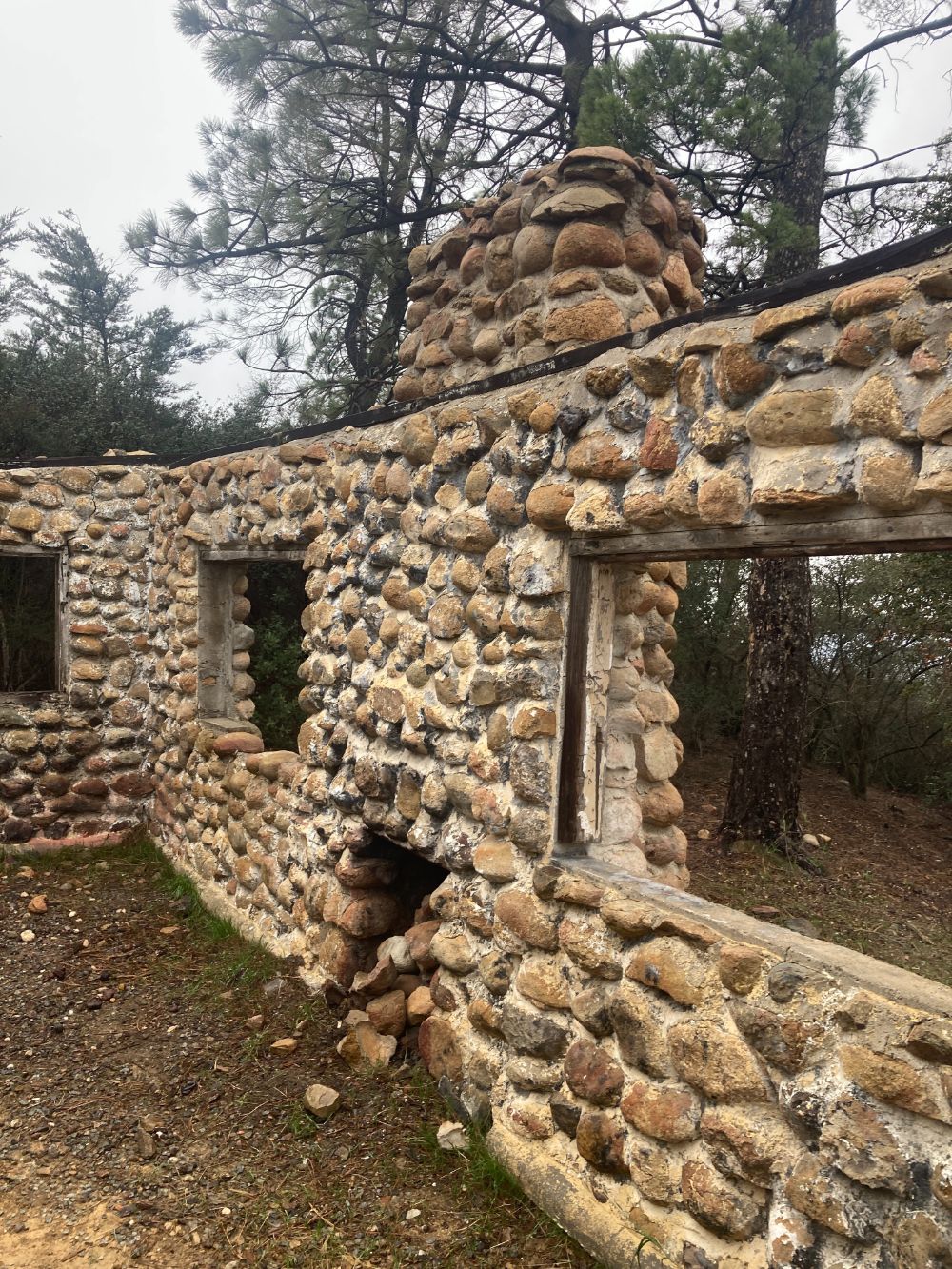
Ruins On The Way To The Doppler
When you are almost to the Doppler ball you will come across two ruins. It looks like two separate shelters, but there was no information about them. All that is left are some stone walls amongst some mature trees that are definitely not native to the area. According to Corona Heritage.org, the ruins are the remains of two cabins that were built in 1930 by Joseph Beek. One cabin was a vacation get-a-way and the other was for the caretaker. Mr. Beek also planted the trees around the ruins and installed a few cisterns to supply the water for them.
The property is still owned by the family, but they stopped using the cabins in the ’80s because it was too hard for them to keep up with the theft and vandals. I saw this location listed on a site about local ghost towns, but I’m not sure if two houses add up to a ghost town.
One Last Push
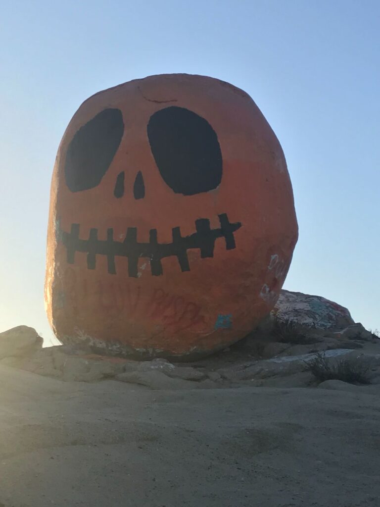
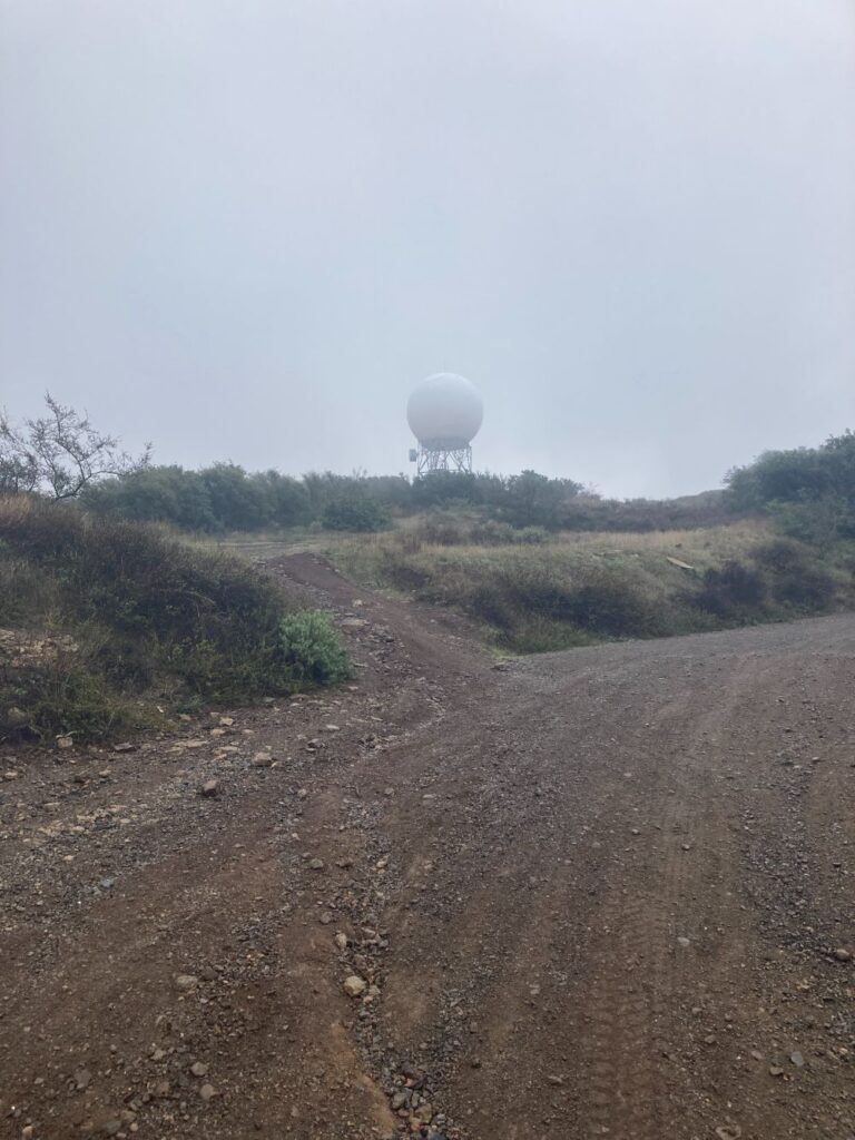
After the ruins, it’s about 800 feet of climbing to the Doppler ball. The Doppler ball was “meh.” We took a picture to prove that we were there and looked around for a minute, but the view wasn’t great because of the rain. On a clear day, you can see Catalina, but all we saw were clouds. We went back down to the ruins to eat our lunch. Luckily, it had stopped raining for a few minutes, while we ate. After lunch, we walked the 6 miles back to our car. Of course, it started raining again, and we were drenched and splattered with mud by the time we got to the car.
Final Thoughts
If I lived in Corona I would use Skyline Drive Trail as a conditioning hike, but I think for me this hike goes in the “one and done category.” I can’t stress this enough, do not plan on hiking here if it is hot or even on a warm day with full sun, because you will roast.